


Drone & SLAM Scanner Volume Measurements: Accurate and Efficient Solutions
Are you looking to get precise and reliable volume measurements for your quarries, construction sites, or indoor warehouses? AeroDetect offers innovative drone photogrammetry and advanced SLAM LiDAR scanning technologies, enabling fast and efficient volume calculations for stockpiles of any size, both outdoors and indoors without GPS. Get a quote today!
(A one-time measurement starts from €190. For optimal earthworks or inventory control, we recommend periodic measurements for which we can offer customized terms.)
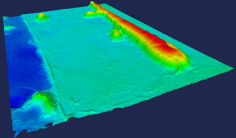
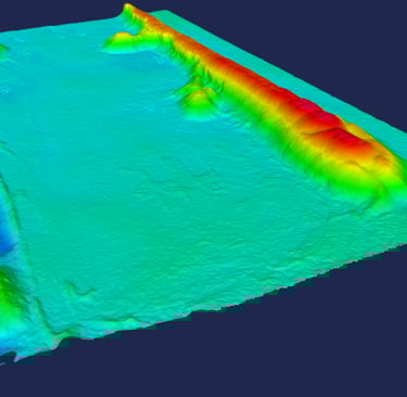
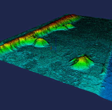
Volume Calculation Method Using Drones and SLAM Technology
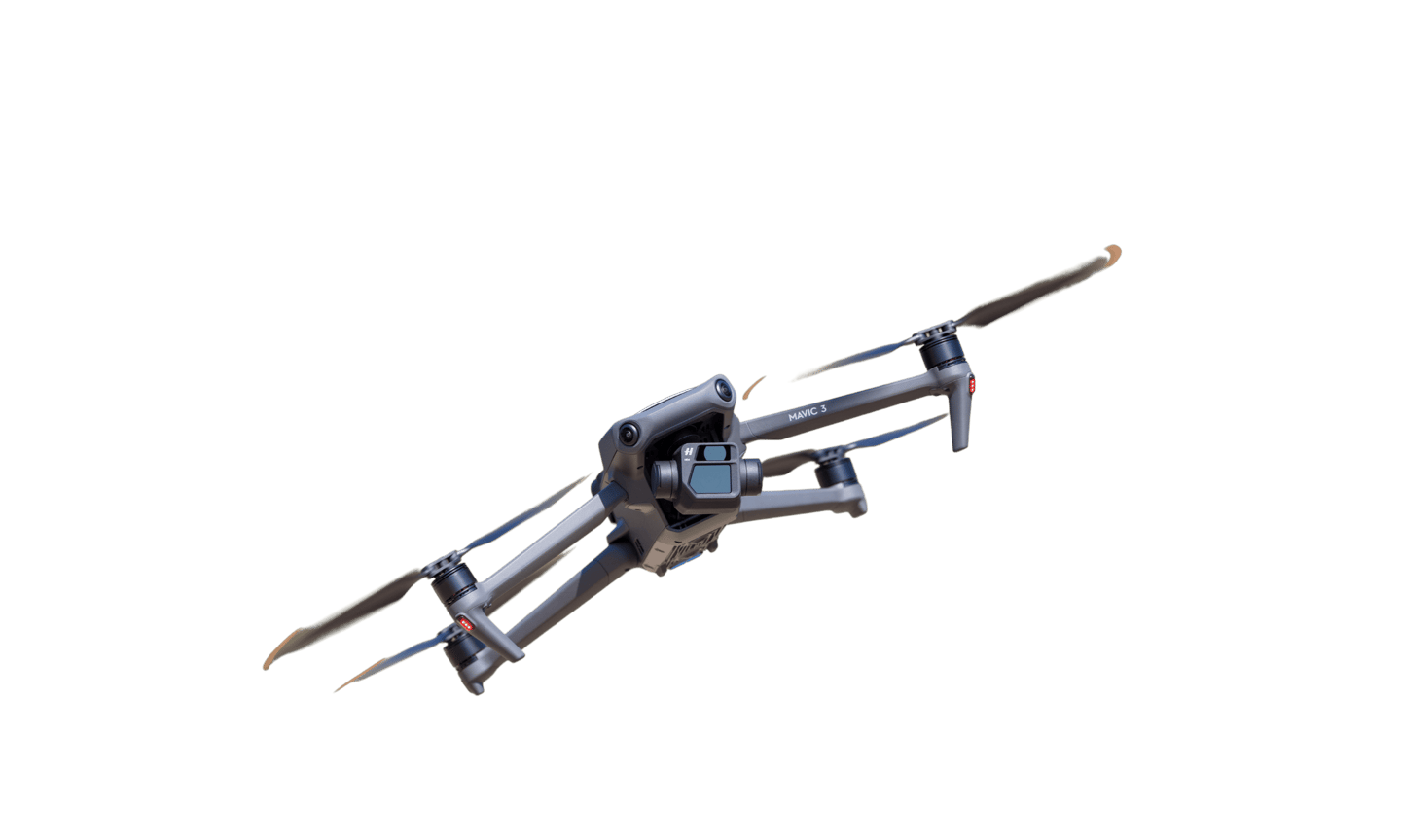
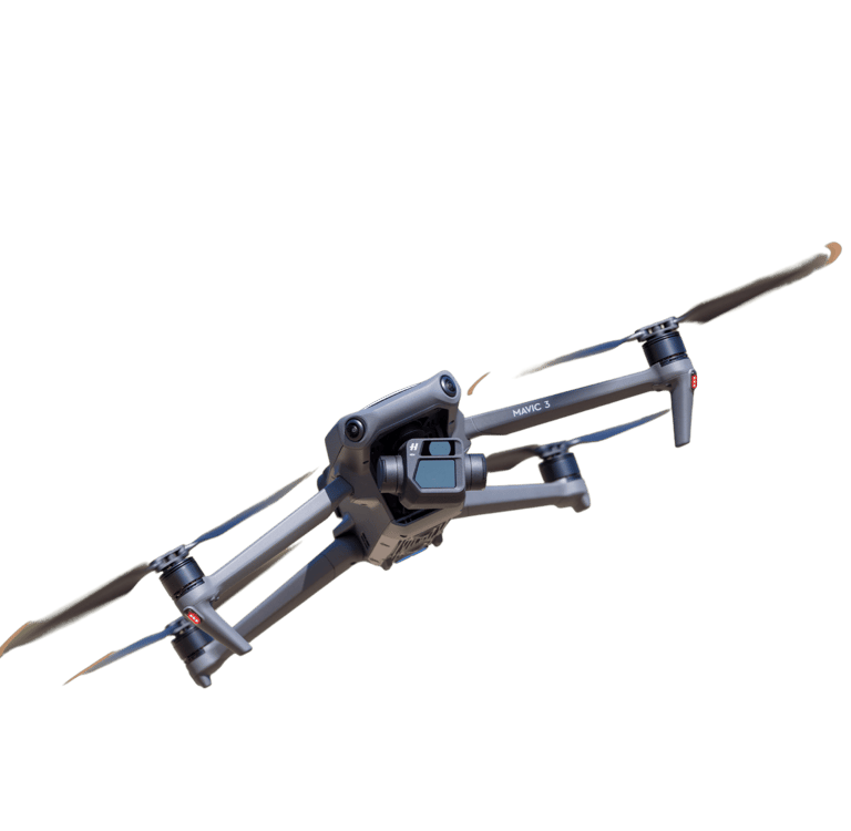
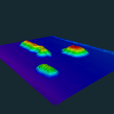
For outdoor projects, our drones are equipped with advanced RTK technology that refines GPS signals and ensures highly accurate coordinates. For indoor environments (such as biomass or salt warehouses) where GPS signals are unavailable, we utilize state-of-the-art SLAM (Simultaneous Localization and Mapping) LiDAR scanners. The captured data is processed using advanced 3D software to generate detailed point clouds and 3D models, allowing for precise volume calculations in any environment.

Applications of drone volume measurements
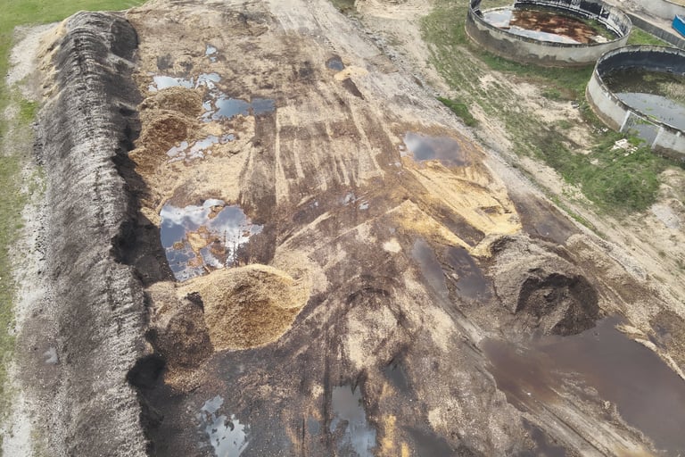
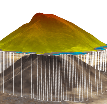
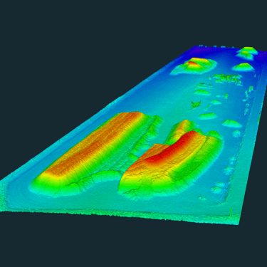
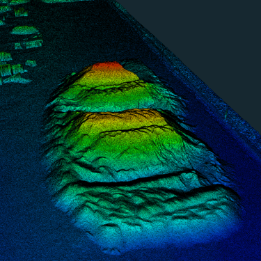
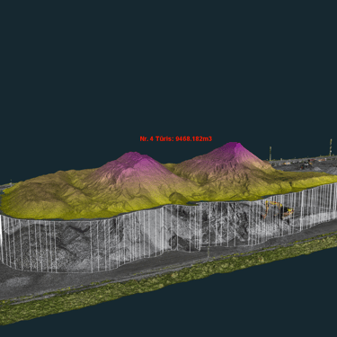
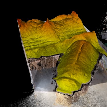
Quarry volume calculation: Accurate measurement of quarry volume helps in planning mining operations, monitoring the amount of excavation, and controlling stockpiles.
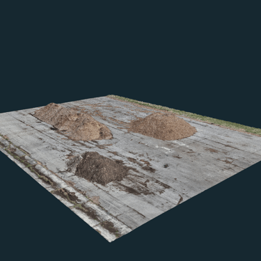
Bulk cargo volume calculation: Drones can accurately calculate the volume of bulk cargo, such as grains, sand, gravel, and more.
Excavation volume calculation: Our technology allows for the precise estimation of the volume of excavated earthworks, such as peat, clay, or sand.
Mineral exploration: Drones can be used to locate and assess new mineral resources, such as sand or gravel deposits.
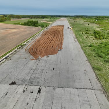
Soil volume calculation: Accurate soil volume measurement at construction sites aids in project planning, material quantity estimation, and cost control.
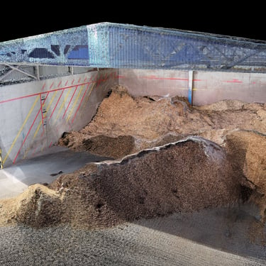
Indoor Warehouse Inventory (SLAM): Highly accurate volume calculation of biomass, salt, fertilizer, or grain stored in enclosed warehouses where traditional GPS drones cannot operate.
How to Measure Soil Volume: Accurate Data from the Air with a Drone
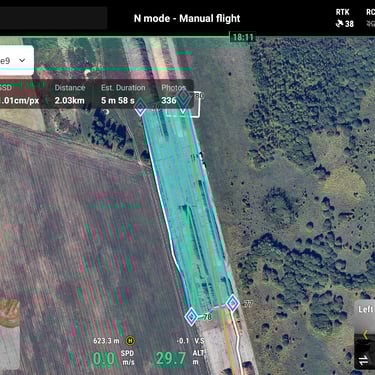
Flight & Scan Planning:
We carefully plan the drone's flight path for outdoor areas or the walking route for indoor SLAM scanning.
RTK Ensures Enhanced Accuracy:
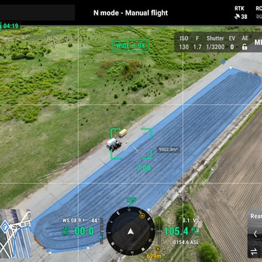
Centimeter-Level Precision with RTK-Equipped Drone
Data Capture:
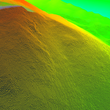
We capture hundreds of high-resolution aerial photos or millions of LiDAR data points, providing a detailed view of your site.
3D Analysis:
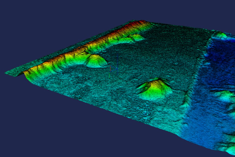
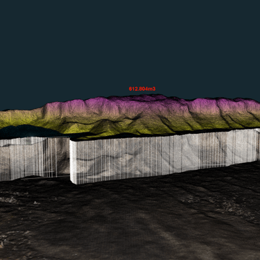
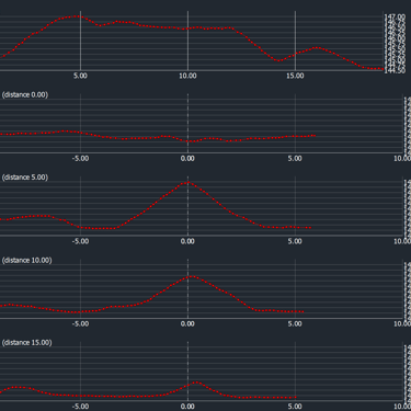
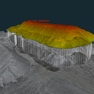
Specialized software analyzes the images or point clouds, stitching them together to create a precise 3D model.
Data Visualization and Reporting:
Transforming Data into Insightful Visualizations and Reports

Advantages of Using Drones and SLAM Scanners:
Versatility: We can measure volumes anywhere – from expansive open-air quarries to fully enclosed biomass storage facilities.
Accuracy: Drones with RTK systems and high-end SLAM LiDAR scanners guarantee high-precision measurements.
Speed: We can quickly and efficiently collect data over large areas, significantly reducing inspection time and costs.
Safety: Remote scanning allows us to access hazardous areas safely without personnel walking over unstable stockpiles.


How are drone or SLAM lidar volume measurements performed?

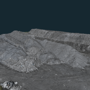
Gallery


Frequently Asked Questions (FAQ)
What is drone and SLAM volume measurement?
It is a modern surveying method that uses RTK-equipped drones for outdoor spaces and SLAM LiDAR scanners for indoor spaces to create precise 3D models. From these models, the volume of various materials—such as soil, sand, biomass, or salt—can be calculated with extreme accuracy.
How long does the measurement process take?
Data collection by drone is significantly faster than traditional methods. The flight itself, depending on the size of the object, can take as little as a few dozen minutes. The entire process, from planning to report delivery, depends on the complexity of the project but is much more efficient.
What objects' volumes can be measured?
This technology can be used to measure various objects: quarry excavations, quantities of bulk cargo (grain, sand, gravel), soil stockpiles on construction sites, and peat or clay excavations. The method is also applied for the exploration of new land resources, such as sand or gravel deposits.
How is drone-based volume measurement superior to traditional methods?
Compared to traditional methods, drone measurement is faster, as large areas are surveyed in a short amount of time; safer, as it eliminates the need for workers to physically enter potentially hazardous areas; and more comprehensive, because a detailed 3D model is created.
What is the accuracy of the measurements?
We use drones equipped with RTK technology, which refines GPS signals and ensures centimeter-level accuracy. This allows for obtaining highly reliable and precise data.
How much does the volume measurement service cost?
The service price starts from €190. The final price depends on the size of the object being measured, its location, and the frequency of measurements. To get a precise quote, please contact us.
In what format are the results delivered?
After the flight and data processing with specialized software, you will receive a detailed report in PDF format. It will contain precise volume calculations based on the created 3D model.
Can you measure volumes inside enclosed warehouses?
Yes. For indoor facilities like biomass or salt warehouses where drones cannot fly using GPS, we use handheld SLAM LiDAR scanners. This allows us to map the indoor stockpiles accurately without needing a satellite signal.


1. Step - Contact us
2. Step - Get a Proposal
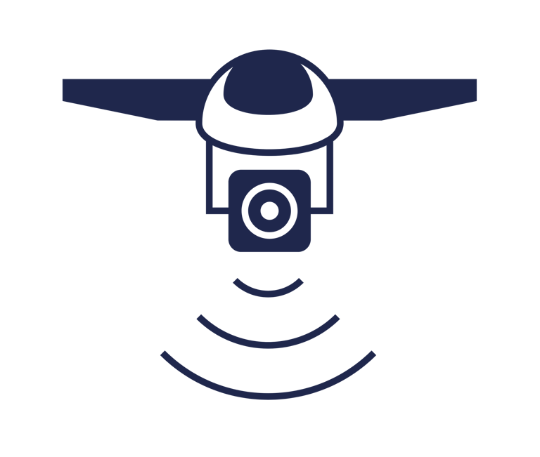
3. Step - Drone Flight
4. Step - Receive a Measurements Report
Drone-Powered Volume Measurement: Precision, Efficiency, Savings
Whether you're dealing with construction materials, grain, or earthworks, our drones can precisely calculate the volume of any object. Contact us today to discover how our services can save you time and money!
Contacts
info@aerodetect.lt
+37068424660